Foxtech Provides Industrial Drone Solutions & UAV Payload Systems.


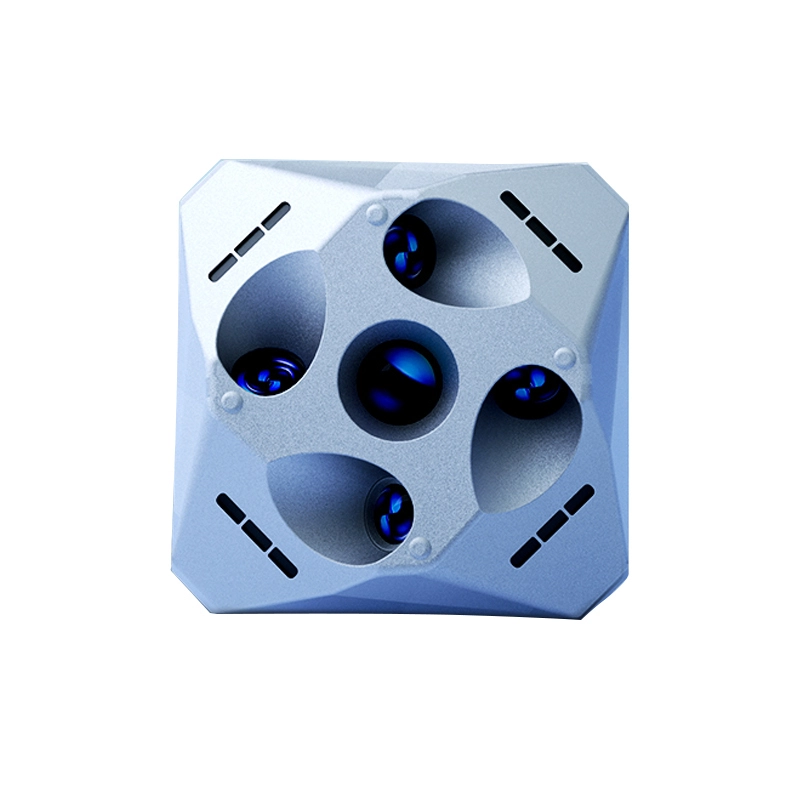
Oblique Camera DJI M300 M350 RTK 12.6 MP 5-Lens JPG APS-C DP500
Features:
Free image control
Mechanical global shutter
Real-time POS timestamp
Centralized storage
The DP500 is a high-performance oblique mapping camera system engineered for aerial surveying and 3D modeling tasks. Featuring five APS-C format sensors and a total resolution of 126MP, the DP500 delivers high-precision, multi-angle imagery ideal for creating accurate digital surface models and orthophotos.
To ensure optimal image quality during fast drone operations, the DP500 incorporates a mechanical global shutter capable of 1/2000s exposure, reducing motion blur and minimizing distortions. The system also features an adjustable pitch angle (8°–24°), allowing the lens to maintain vertical alignment with the ground during different flight speeds.
Designed for compatibility with DJI M300 RTK and M350 RTK platforms, the DP500 includes real-time image transmission, enabling operators to view live footage via ground control systems. Its integrated 640GB storage module supports transfer rates of up to 300MB/s, simplifying data management and boosting field efficiency.
The camera is further enhanced with real-time POS timestamping and route planning support via DJI Pilot PE and Drone Butler software, making it an all-in-one solution for precise aerial data collection. From urban planning and asset inspection to large-scale land surveys, the DP500 sets a new standard in professional drone photogrammetry.